By John Sparks, Volunteer, Trailkeepers of Oregon Distance: up to 10.6 miles / Elevation gain: up to 2,405 feet For an early summer excursion in Oregon’s northern Blue Mountains, try the well-graded Rough Fork Trail, which descends 1,800…
by John Sparks, Newsletter Editor, Trailkeepers of Oregon
Distance: 8.2 miles one-way
Elevation gain: 1,550 feet
The Clackamas River Trail is a perfect December outing as the area should be snow-free but less visited and the old-growth groves impart a greater majesty in the diffused light. Trailkeepers of Oregon has returned to the trail every year to patch up eroded sections of trail and improve stream crossings. There are several options here: most people prefer the 7.8 mile return trip to Pup Creek Falls from the Fish Creek Trailhead; others may wish to begin at the Indian Henry Trailhead, which requires no fee and takes you directly into the Clackamas Canyon section of the Clackamas Wilderness; still others may prefer this as a through-hike with a car shuttle, a hike-and-bike (leave your bike at Indian Henry and start hiking at Fish Creek), or an undulating 16-mile out-and-back excursion.
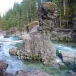
The Clackamas River is constricted as it flows past basalt buttresses at The Narrows. (Photo by John Sparks)
The Clackamas River flows through a narrow defile in the Columbia River Basalts here. High cliffs above the opposite bank display successive lava layers. The Clackamas carved this canyon on an 83-mile run from the west slope of Olallie Butte to the Willamette River at Oregon City. The entire area is a catchment of pristine river systems that are part of the National Wild and Scenic Rivers system. In addition to the Clackamas itself, these include the Collawash River, Roaring River, South Fork Roaring River, Fish Creek, and the South Fork Clackamas River.
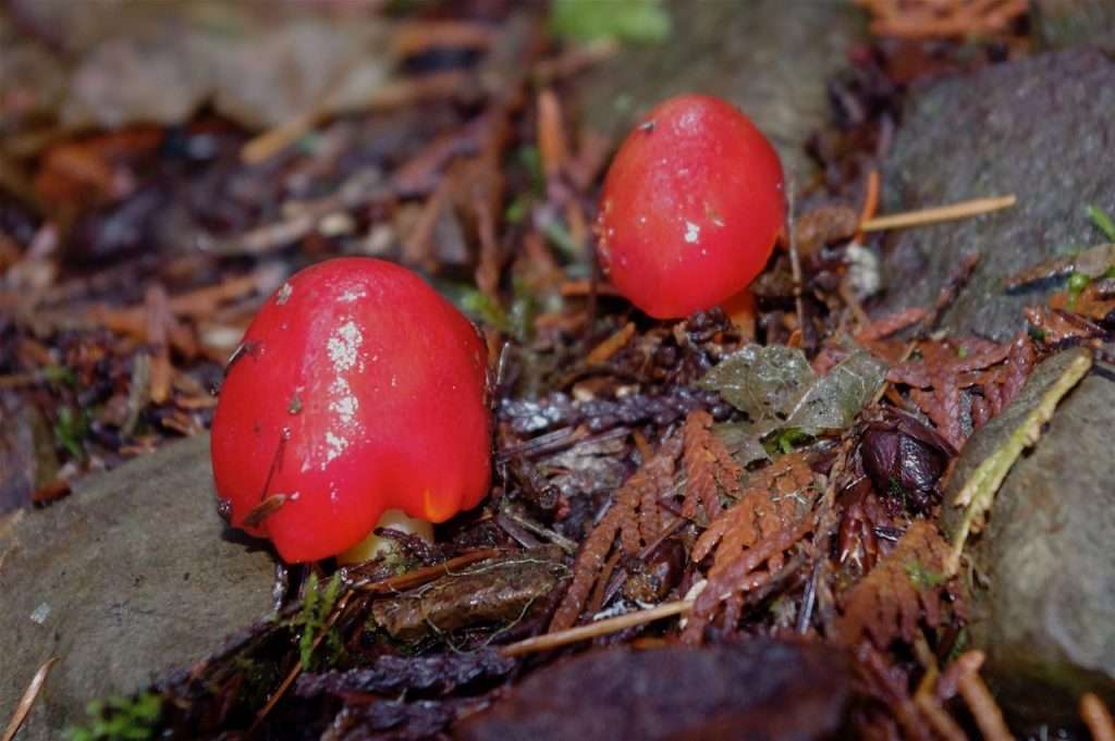
Scarlet waxy cap (Hygrocybe punicea) sprouts in the duff along the Clackamas River Trail. (Photo by John Sparks)
Bright red waxy caps (Hygrocybe punicea) are winter mushrooms that emerge in small clusters on the forest floor. Initially cone-shaped, they will spread their caps to reveal thick yellowish gills and orange stalks. They are found in forests throughout North America and in northern European pastures. Some sources claim a symbiotic relationship with mosses. Waxy caps are marginally edible and may cause some
consumers stomach distress.
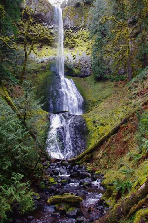
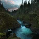
Tall, narrow Pup Creek Falls spills into its luxuriantly green amphitheater.
(Photo by John Sparks)
The Northwest Waterfall Survey puts Pup Creek Falls at 237 feet. The waterfall spills over a classic basalt lip in two tiers. Trailkeepers of Oregon has improved the quarter-mile access trail to the falls in recent years, allowing for better views of this spectacular waterfall in its verdant amphitheater enhanced by bright mosses and lichens with a dense canopy of conifers. The best times to visit are November to June during the annual rainy season.
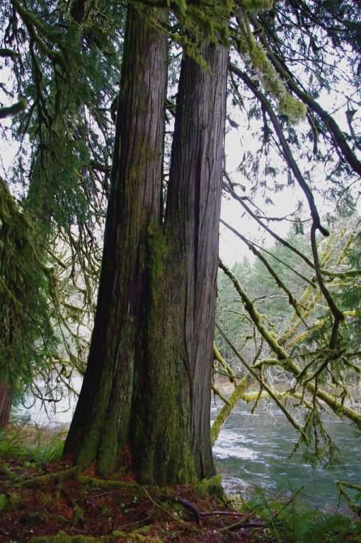
A double-trunked western red-cedar shades the bank of the Clackamas River.
(Photo by John Sparks)
Western red-cedar (Thuja plicata) is a feature of river bottoms throughout western Oregon. Farther up the Clackamas, in another section of the Clackamas Wilderness at Big Bottom, you’ll find one of the largest intact groves of old-growth red-cedars in the state. The cedar’s resistance to decay made it the most important wood for West Coast Native Americans in the construction of plank houses and canoes. It was also the first-choice timber source for Euro-American settlers, who rapaciously plundered cedar bottoms of most of the old growth. Slow-growing, it was replaced as the favored plantation conifer by quickly maturing Douglas-fir, an economic choice that defines the timber culture we have today.
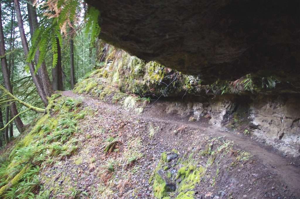
The Clackamas River Trail runs through Half Cave under a basalt overhang. (Photo by John Sparks)
Near its southern terminus at the Indian Henry Trailhead, the Clackamas River Trail takes advantage of a weakness in the layers of Columbia River Basalts to negotiate a cliff face under an overhang. Half Cave is a feature of the Clackamas Canyon section of the Clackamas Wilderness, which runs from Indian Henry to The Narrows. The Clackamas Wilderness, five disjunct segments spread 50 miles apart, was designated in 2009 under the Omnibus Public Land Management Act, a law which also created the nearby Roaring River Wilderness, other small wildernesses in Oregon, and added significant acreage to some existing wildernesses in the state. The other sections of the Clackamas Wilderness are the South Fork, Memaloose Lake, Big Bottom, and Sisi Butte.
See the Clackamas River Trail Hike in the Oregon Hikers Field Guide for more details and trailhead information.
John Sparks: john.sparks@trailkeepersoforegon.org